Aerometrex

 +61 8 8362 9911

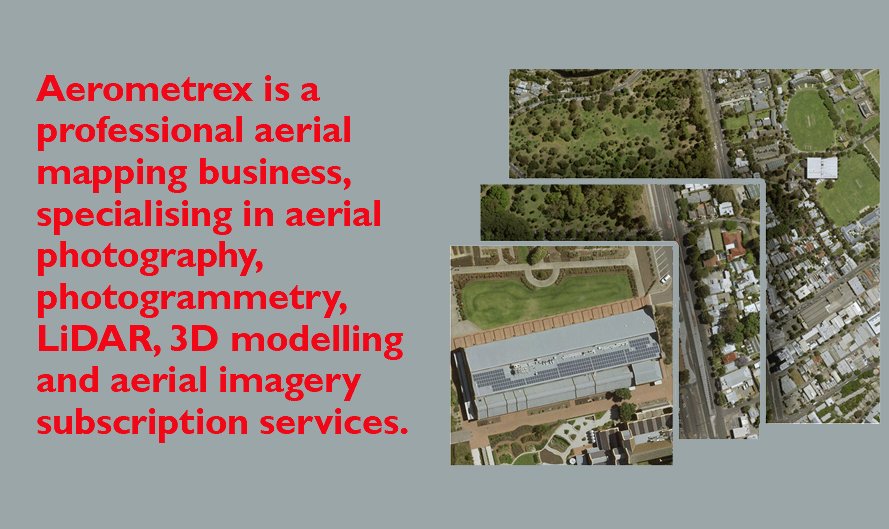
Aerometrex is a professional aerial mapping business, specialising in aerial photography, photogrammetry, LiDAR, 3D modelling and aerial imagery subscription services.
Established in 1980, the company is headquartered in South Australia and operates in all the states and mainland territories of Australia. Since 2015, Aerometrex has also delivered projects across France, Germany, New Zealand and the United States. Aerometrex is a member of every state government’s panel of aerial photography providers and its services are used by state and local governments.
Services:
Aerial photography and mapping – The key products from this activity are aerial photographs, orthophotography (scale-corrected 2D aerial imagery maps), Digital Terrain Models (DTMs), Digital Surface Models (DSMs), and digitised 3D feature data for Geographic Information Systems.
Aerial LiDAR surveys – Aerometrex provides an aerial LiDAR surveying service, an advanced aerial surveying technique which accurately maps the ground surface using airborne lasers.
3D modelling – Aerometrex has developed a sophisticated 3D modelling and mapping system derived from oblique aerial photographs. It offers 3D models of the highest resolution (1cm-2cm pixel) and absolute accuracy (5cm in the XY & Z dimensions) derived from aerial platforms.
Metromap – Aerometrex provides an online aerial imagery web-serving application, MetroMap which offers high-quality, accurate imagery to a subscriber base. MetroMap fulfils all of the quality and accuracy requirements of sophisticated geospatial data users and provides an easy-to consume product for the corporate market, via a web browser interface.
Why Choose Aerometrex:
Aerometrex considers the business has the following strengths:
High data quality: Measured for imagery by resolution (pixel size), colour balance consistency, lack of imagery artefacts and measured for LiDAR by seamless modelling of the ground surface and classification of the data into ground and non-ground features
Great Accuracy: This is determined by measuring residual errors at known surveyed ground control points. Aerometrex’s products meet the highest government, industry and surveying standards for quantitative applications such as measurement, artificial intelligence (AI) derived information extraction and change detection
Multiscale 3D modelling capability: Aerometrex has the capability to provide seamless 3D mesh models that combine multiple resolutions captured from various platforms (fixed-wing, helicopter, ground) into a single seamless 3D model
High standards of customer service: Professional, timely and accurate advice is provided to clients by a team which is accustomed to handling and project managing over 550 projects per annum
Experienced People: Aerometrex has an experienced, production-hardened workforce of over 80 staff, with a total of over 770 years’ industry experience. Considerable ‘know-how’ and intellectual property has been accumulated by Aerometrex and is in daily use by its staff
Historical Data archive: Aerometrex has access rights to aerial imagery data sets dating back as far as 1943. Aerometrex has archive data of its own capture programs back to 2002. It has full intellectual property rights on aerial imagery coverages for every mainland capital city and full or shared intellectual property rights on many rural and regional coverages.